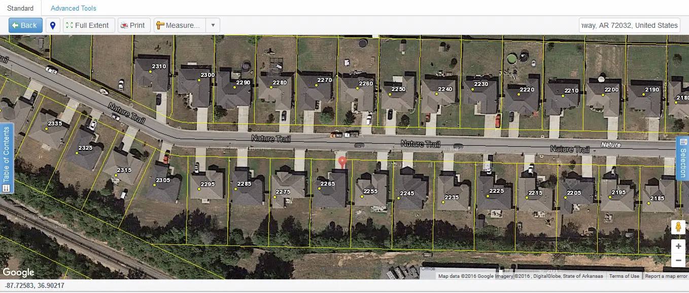
Mapping
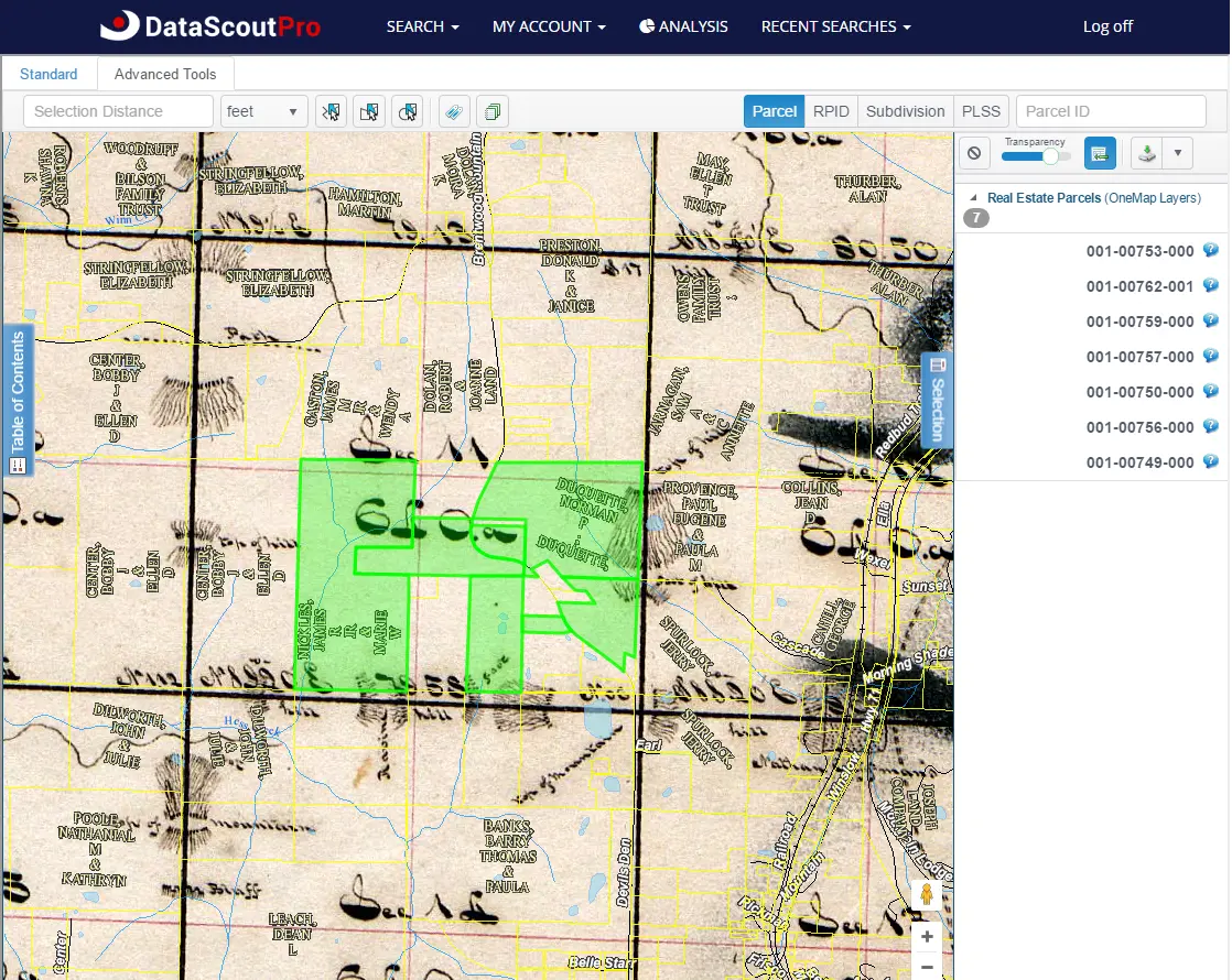
DataScoutPro introduces the DataScoutPro OneMap viewer, a web-based function integrated with County and City GIS parcel boundaries, various layers, measuring tools, locating feature, printing, and more. These combined with a point-and-click application allows users to visualize real property data.
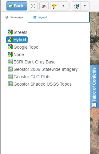
Basemaps and layers
Mapping Tools
Utilize a variety of tools, executing various functions.
- • Locate Me
- • Full Extent View
- • Measure Tools
- • Google Location Search

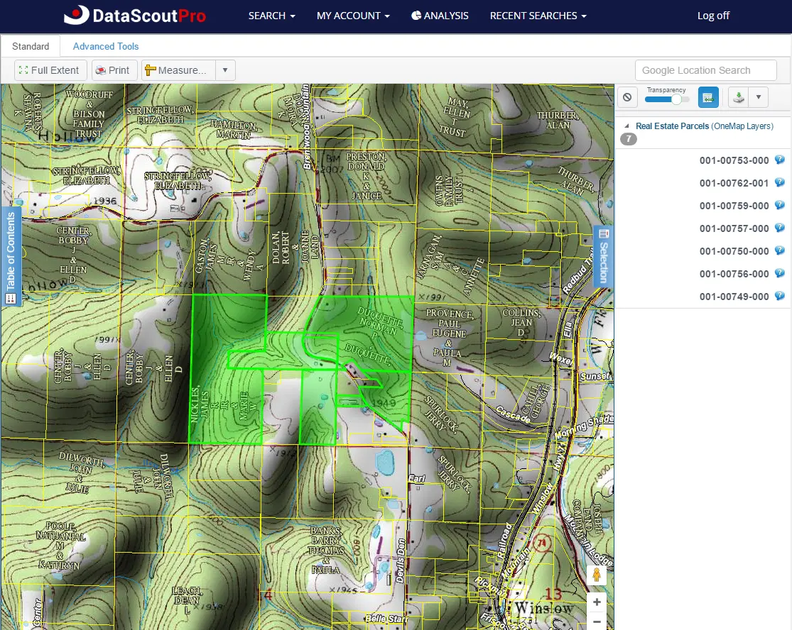
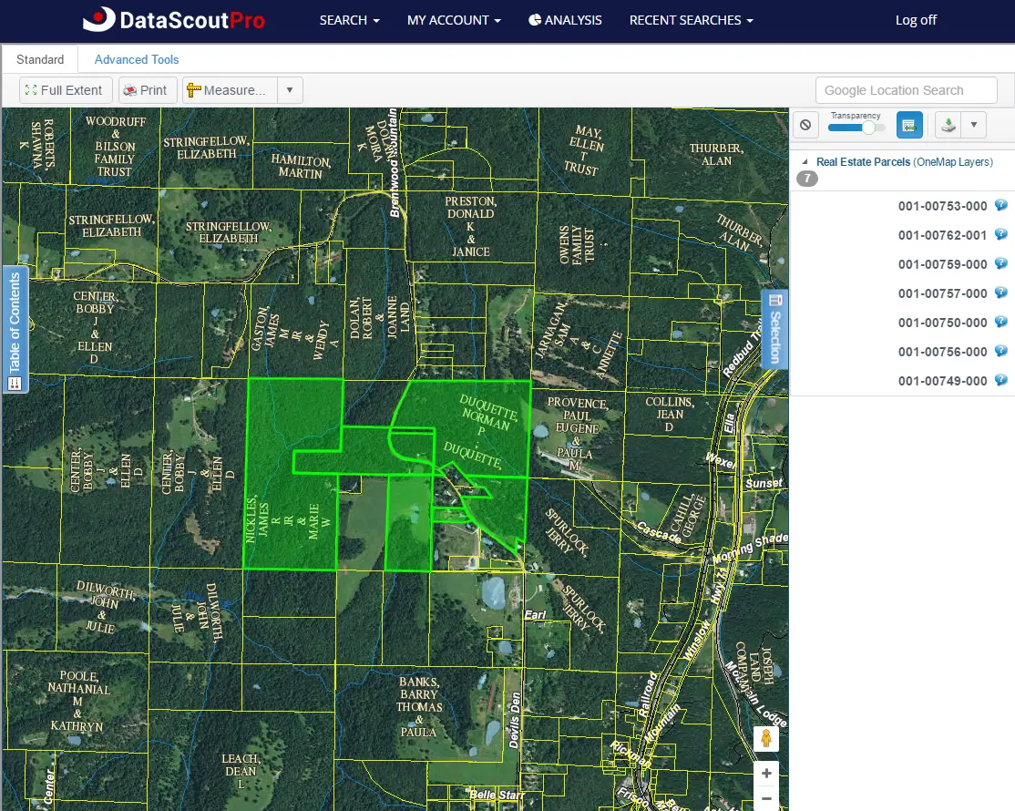
Selection Tab
Listing of one more parcels, coupled with functions enabling numerous actions.
- • Clear
- • Transparency Slider
- • Multi-Select
- • Mailing Labels
- • Batch Print
- • Parcel Details
- • Zoom to Feature
Map Viewer
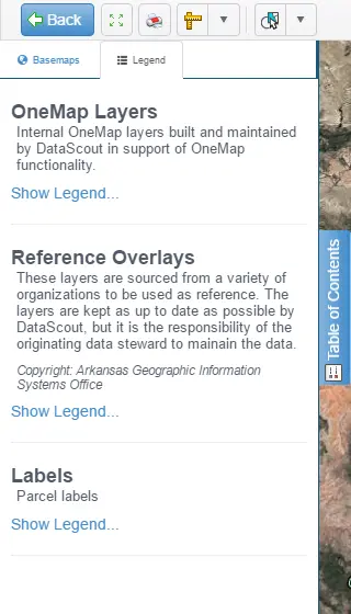
Table of Contents - Basemaps
Table of Contents - Legend
Mapping Tools
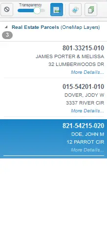
Select Tab - Parcel List
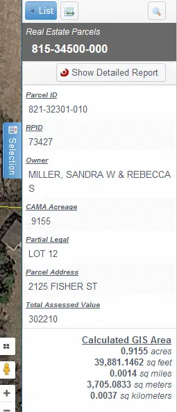
Selection Tab - Parcel Information
DataScout News
Is your DataScoutPro account up to date?
11/13/2024 4:41:40 PM
Dear DataScoutPro User,
DataScout references your account information for website communication and to verify your identity. Please take a few moments to update your account information on DataScoutPro.com. You can make these changes by visiting the My Account tab in the blue header of the website.

Please let us know if you have any questions.
Thank you,
Your DataScoutPro Support Team
E: support@datascoutpro.com
The NEW Customizable Bulk Data Export is here!
8/18/2021 11:15:59 AM
IT'S HERE! The new Customizable Bulk Data Export is ready! Are full county or state exports a little more than what you need? Then the new Bulk Data export is for you! Whether you're looking for all sales in the past year in one or more counties or all out-of-state property owners, the new export has an option that fits most needs.
Only available for Arkansas and Oklahoma